日和田山:埼玉百名山
MOUNT HIWADA
2026年5月21日(木)
¥3,300円(税込)(西武鉄道高麗駅8:00集合)
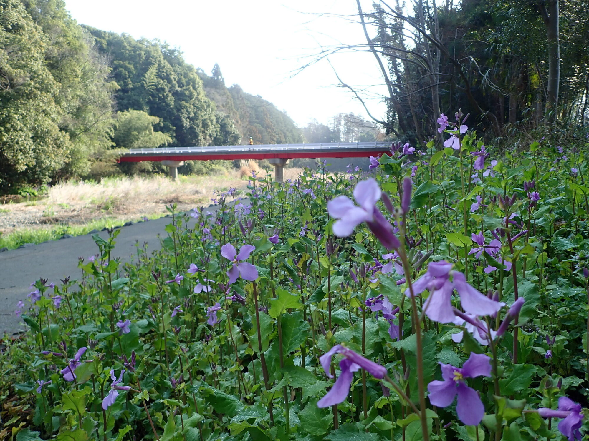
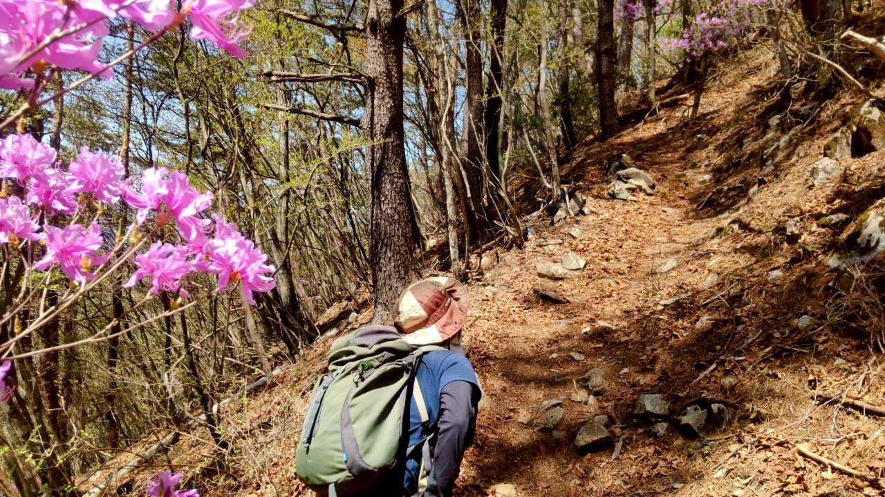
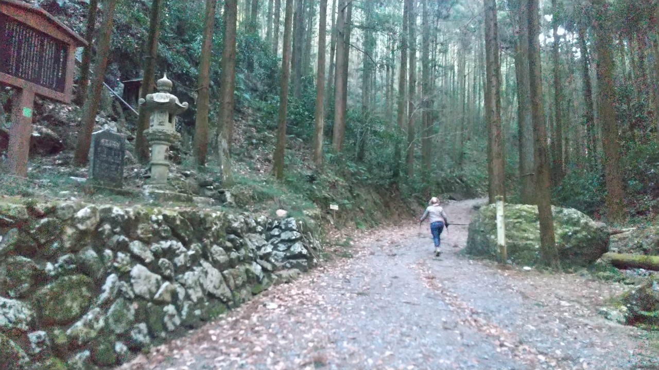
日和田山(ひわださん)は、埼玉県日高市にある標高305mの奥武蔵の山の一つである。 最寄駅の高麗駅からのコースを辿ると、山頂まで約2km。途中、巾着田が眺められたり、金比羅神社そばを通る。高麗駅方面から金比羅神社へ向かう途中に『男坂』『女坂』と呼ばれる坂道があるが、男坂は急坂できつい岩場となっている。埼玉百名山。
☆登山後の近くのお楽しみ☆彡
巾着田は、春に桜や菜の花、秋に曼珠沙華が咲きます!
栗こま娘という、まるまる栗が1粒入ったお菓子があります!
English
Mount Hiwada is one of the mountains of Okumusashi, located in Hidaka City, Saitama Prefecture, with an elevation of 305 meters. Following the course from the nearest station, Koma Station, it is about 2 km to the summit. Along the way, you can view Kinzaku Field and pass near Konpira Shrine. On the way from Koma Station to Konpira Shrine, there are slopes called ‘Otoko-zaka’ (Men’s Slope) and ‘Onna-zaka’ (Women’s Slope), but Otoko-zaka is a steep slope with challenging rocky areas. It is one of the 100 famous mountains of Saitama.
☆A nearby treat after mountain climbing☆彡.
Kinchakuda has cherry blossoms and rapeseed flowers in spring, and red spider lilies in autumn! There is a confection called Kurikomamusume, which contains a whole chestnut!
ツアー行程表
| 行程 | 行動時間 | |
| 1日目 | 西武鉄道高麗駅(平日8:00集合)(110m)…登山口…金刀比羅神社…日和田山(305m)…高麗駅(110m/16:00解散予定) ※歩行距離:10.4km ※食事:××× | 3~3.5時間 |
三頭山:日本三百名山/東京百名山
MOUNT MITOU
2026年5月28日(木)
¥6,600円(税込)(9:00集合)
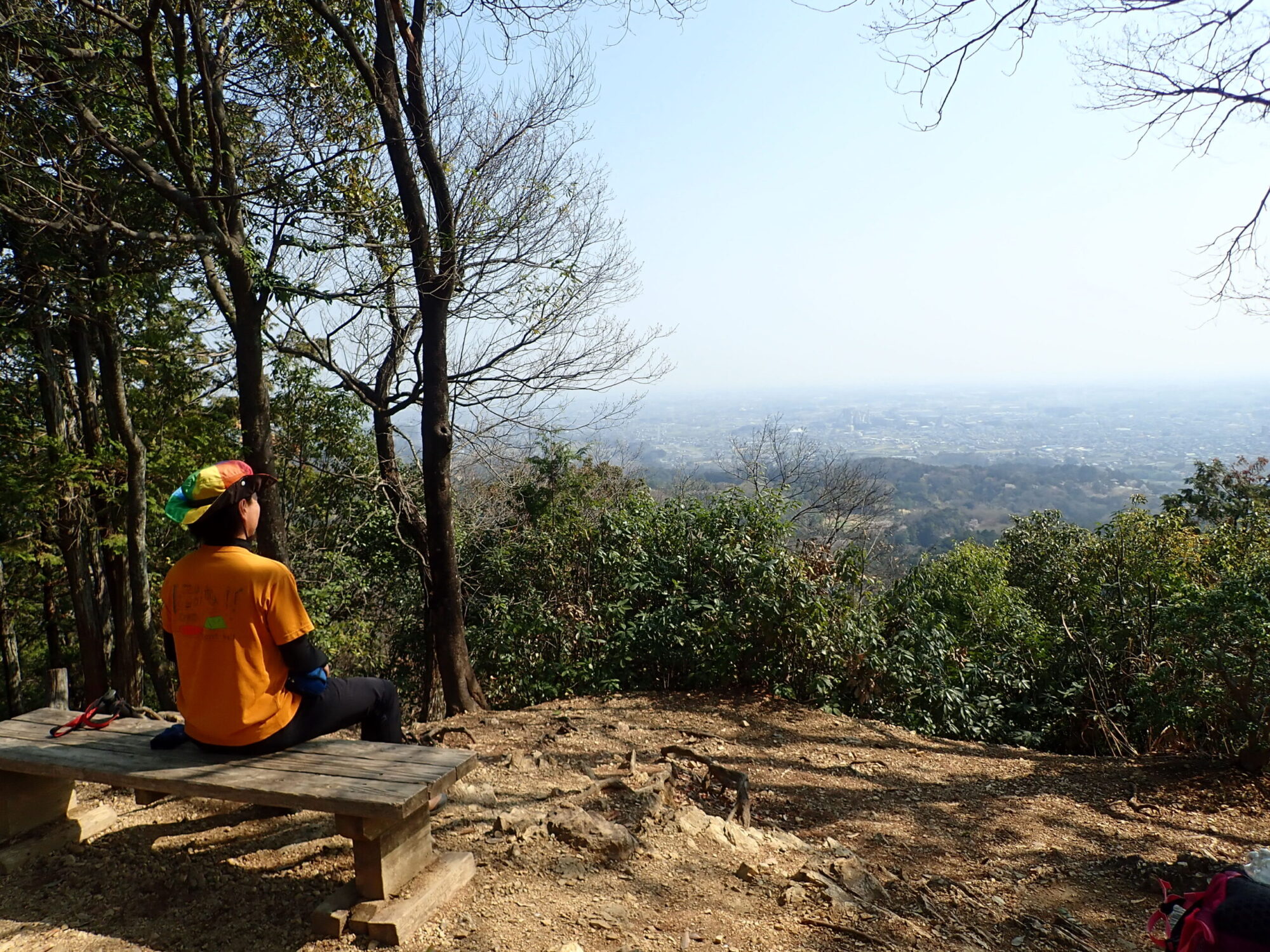
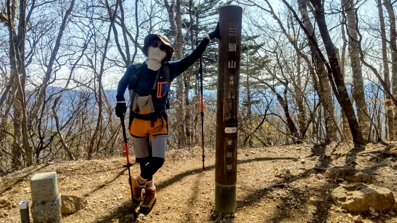
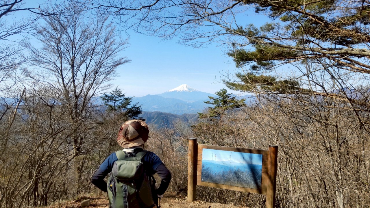
三頭山(みとうさん)は、東京都西多摩郡奥多摩町・檜原村、山梨県上野原市、北都留郡小菅村にまたがる標高1,531mの山である。山頂からは富士山や雲取山、奥秩父山塊、丹沢山地などの美しい景色を楽しむことができます。日本三百名山。東京百名山。
☆登山後の近くのお楽しみ☆彡
東京都檜原都民の森では1年を通してたくさんの花を楽しむことができます。また、レストランも併設されています。
English
Mount Mitou (Mitou-san) is a 1,531-meter-high mountain that spans Okutama Town and Hinohara Village in Nishitama District, Tokyo, Uenohara City in Yamanashi Prefecture, and Kosuge Village in Kitatsuru District. From the summit, you can enjoy beautiful views of Mount Fuji, Mount Kumotori, the Oku-Chichibu mountain range, and the Tanzawa Mountains. It is one of the 300 famous mountains of Japan and one of the 100 famous mountains of Tokyo.
☆A nearby treat after mountain climbing.☆彡
At Tokyo’s Hinohara Citizens’ Forest, you can enjoy many flowers throughout the year. There is also a restaurant on the premises.
| 行程 | 行動時間 | |
| 1日目 | JR五日市線武蔵五日市駅・武蔵五日市駅バス停<西東京バス/各自払い>=都民の森バス停 下車(1時間程)(平日9:00集合)…登山口(1,000m)…三頭山(1,531m)…都民の森バス停(1,000m/13:00解散予定) ※歩行距離:6.3km ※食事:××× | 3~3.5時間 |
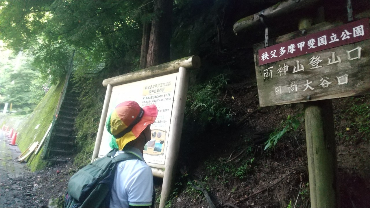
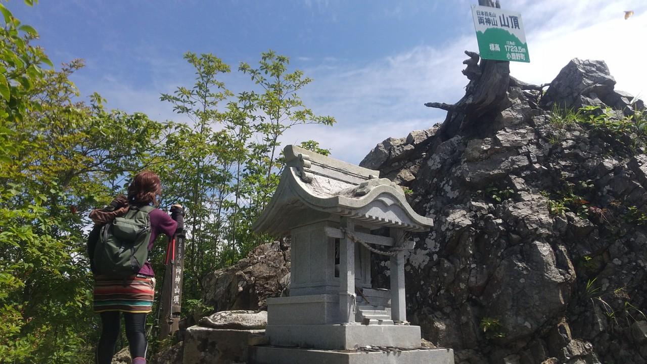
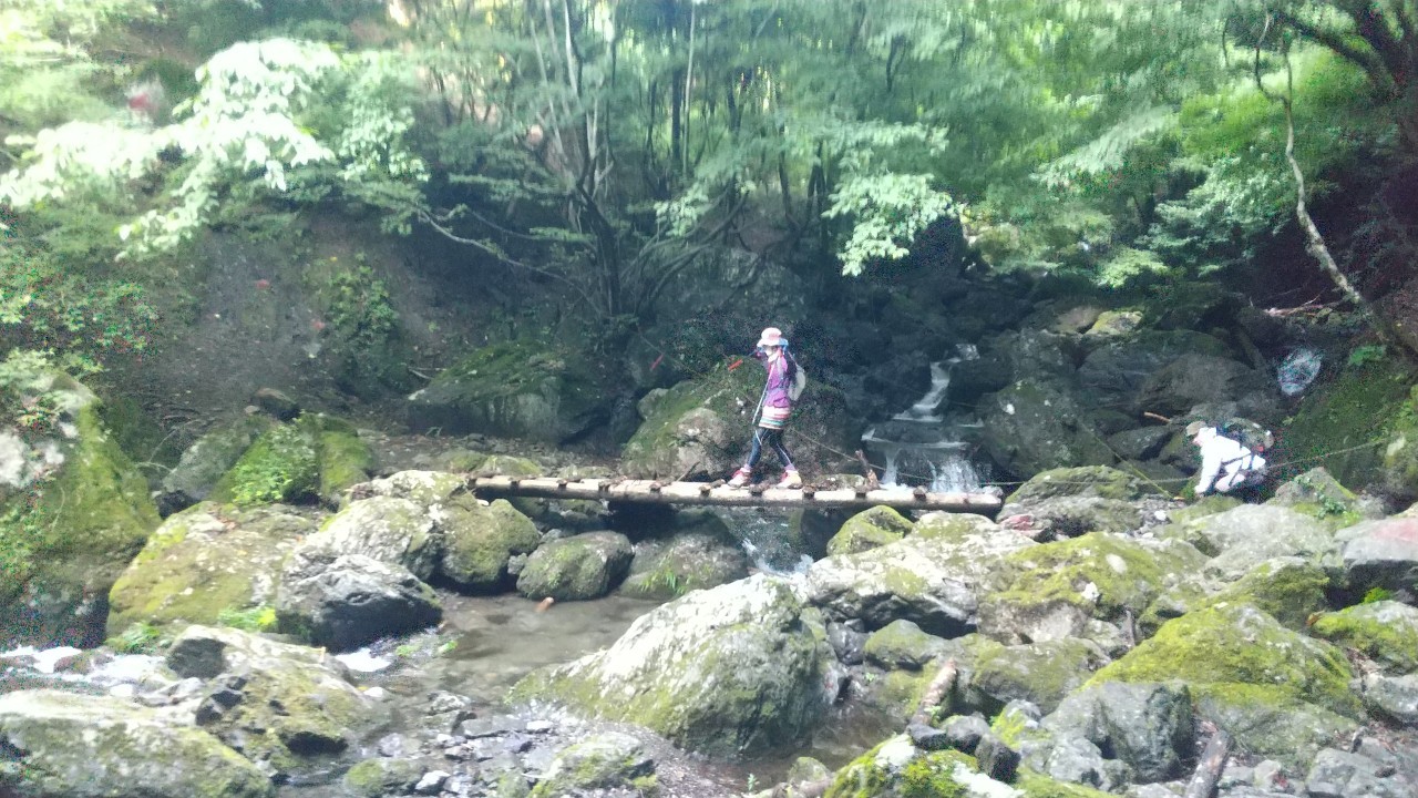
両神山:日本百名山/埼玉百名山
MOUNT RYOUGAMI
2026年6月4日(木)
¥6,600円(税込)(秩父鉄道三峰口駅8:00集合)
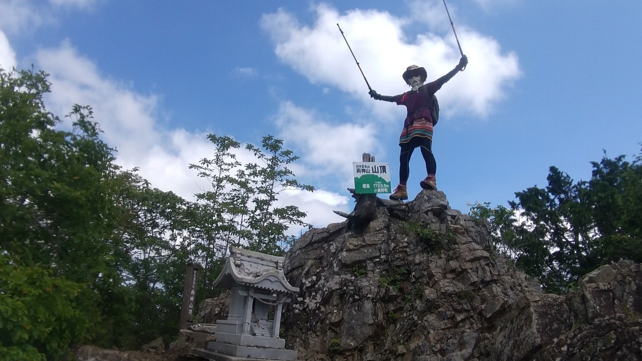
両神山(りょうかみさん)は、埼玉県秩父郡小鹿野町と秩父市の境目にあり、秩父多摩甲斐国立公園内にある山で標高1,723mの山である。山頂から関東平野を一望でき、富士山やスカイツリーを眺めることができます。日本百名山。埼玉百名山。
☆登山後の近くのお楽しみ☆彡
堂上節分草園は、約5000㎡の園地を持ち、群生地として日本有数の規模を誇ります。
English
Mount Ryokami is a mountain located on the border between Ogano Town, Chichibu District, and Chichibu City in Saitama Prefecture, within Chichibu-Tama-Kai National Park, with an elevation of 1,723 meters. From the summit, you can get a panoramic view of the Kanto Plain and see Mount Fuji and the Tokyo Skytree. It is one of the 100 Famous Japanese Mountains and one of the 100 Famous Saitama Mountains.
☆A nearby treat after mountain climbing.☆彡
The Doujou Setsubunsou Garden has a garden area of about 5,000 square meters and boasts one of the largest populations in Japan as a habitat.
ツアー行程表
| 行程 | 行動時間 | |
| 1日目 | 秩父鉄道三峰口駅(平日8:00集合)(324m)三峰口バス停<小鹿野町営バス/各自払い>=日向大谷口バス停 下車(1時間程)(640m)…清滝避難小屋・清滝…両神神社…両神山(1,723.5m)…清滝避難小屋…日向大谷口バス停<小鹿野町営バス/各自払い>=三峰口バス停…秩父鉄道三峰口駅(324m/16:00解散予定) ※歩行距離:10.4km ※食事:××× | 7~8時間 |
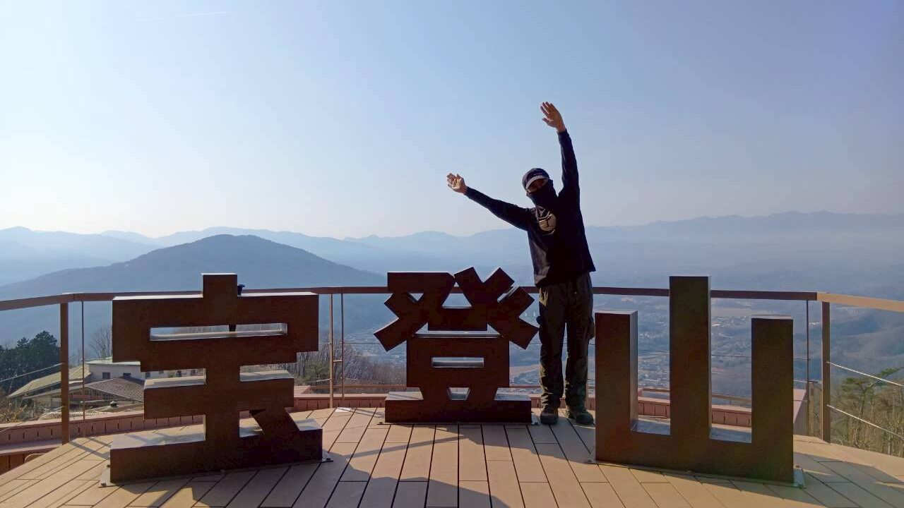
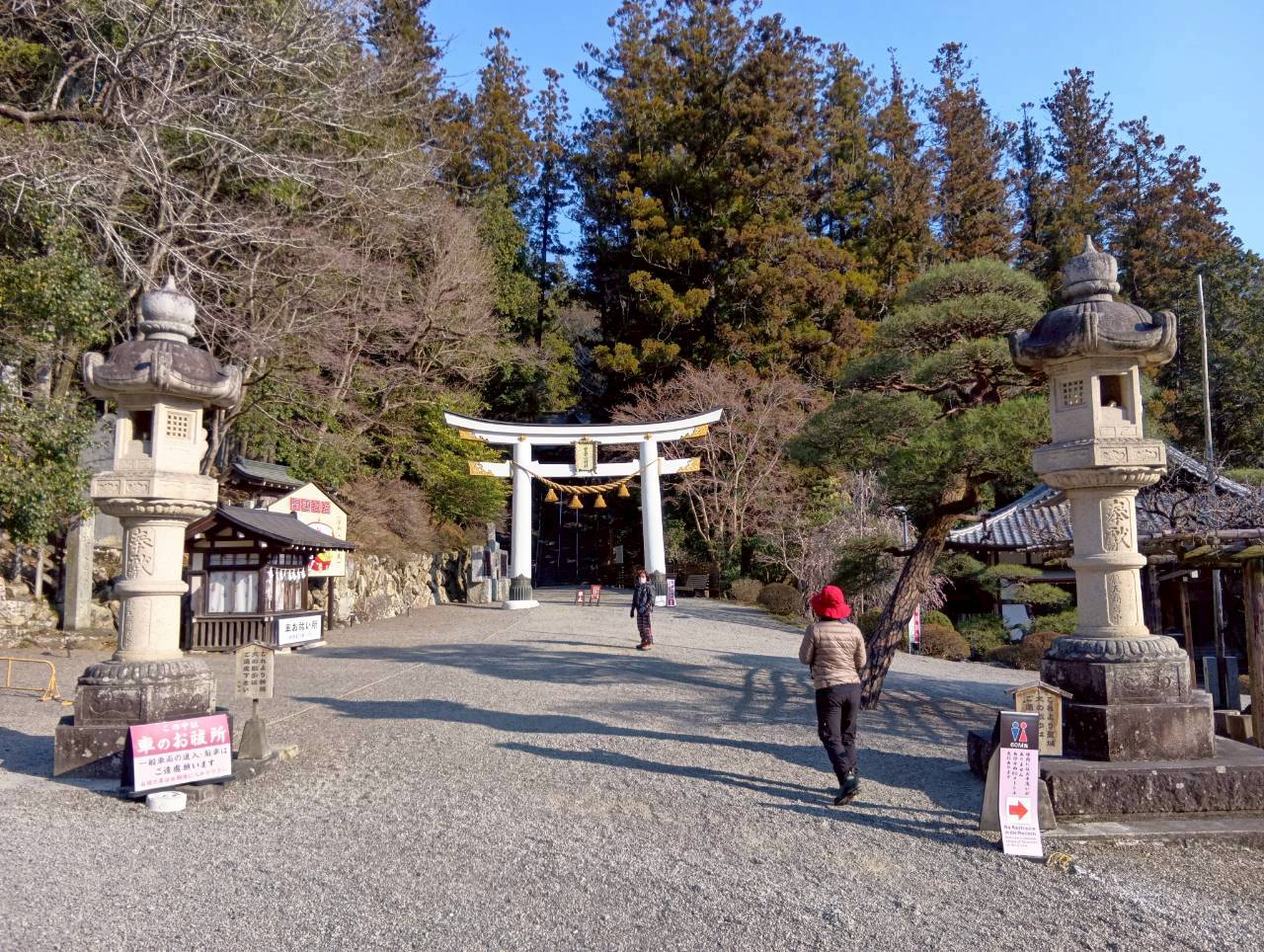
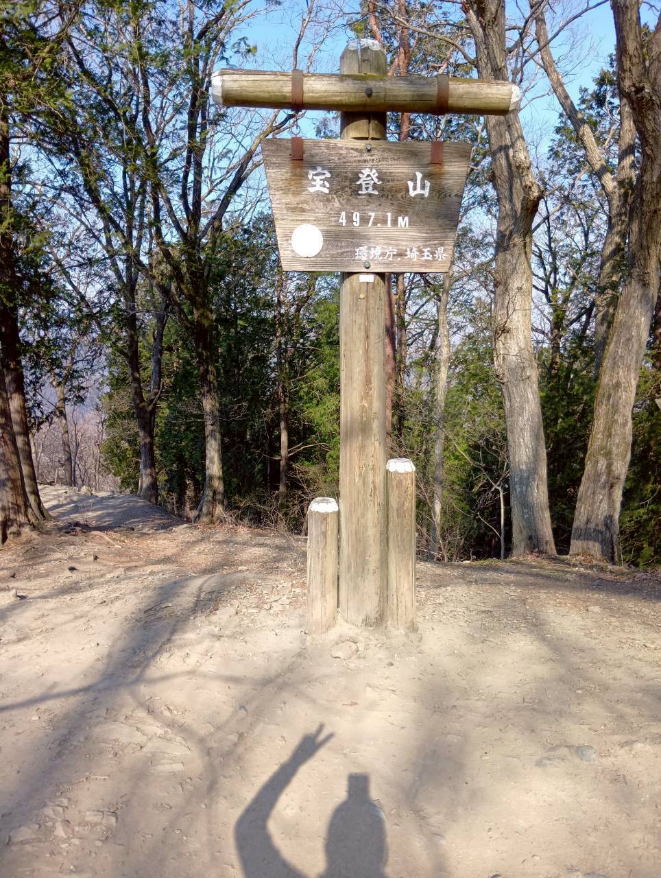
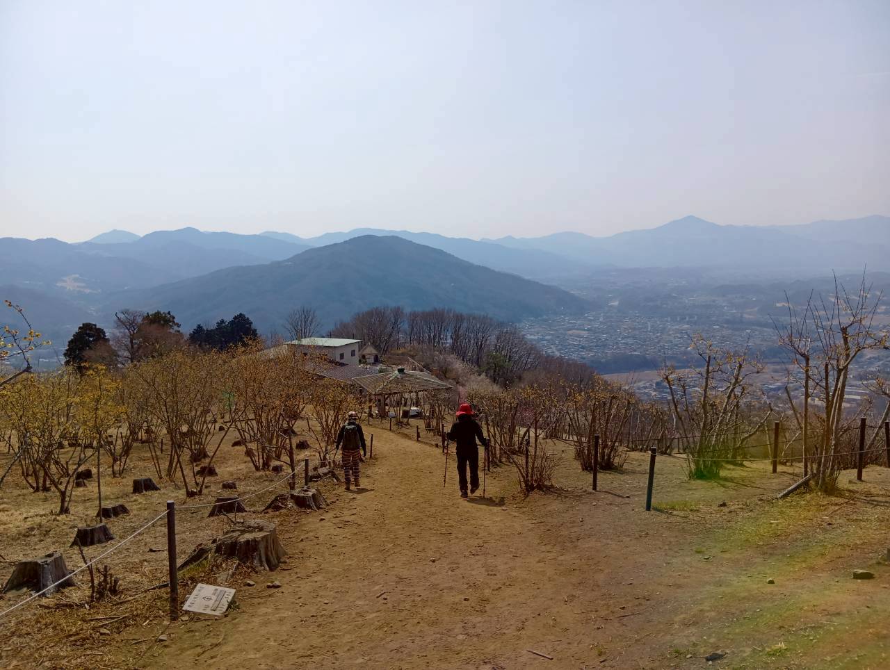
宝登山:埼玉百名山
MOUNT HOTO
2026年6月11日(木)
¥3,300円(税込)(秩父鉄道長瀞駅8:00集合)
宝登山(ほとさん)は、埼玉県秩父郡長瀞町に位置する標高497mの山である。山麓には秩父三社の一つである宝登山神社があり、山頂にはその奥宮が鎮座しています。山頂付近には梅園やロウバイ園、小動物公園が整備され、四季折々の花が楽しめます。山頂からは秩父の街並みや武甲山、両神山などの山々を一望できる絶景スポットです。埼玉百名山。
登山後の近くのお楽しみ。
長瀞駅から高砂駅までの約6kmの桜並木が楽しめます。
そら豆の甘納豆きな粉あえが山登りの疲れを癒してくれます。
English
Hodosan is a mountain located in Nagatoro-machi, Chichibu-gun, Saitama Prefecture, with an elevation of 497 meters. At the foot of the mountain is Hodosan Shrine, one of the three major shrines of Chichibu, and its inner sanctuary is located at the summit. Near the summit, there are plum orchards, winter sweet gardens, and a small animal park, where visitors can enjoy flowers throughout the seasons. From the summit, it is a spectacular viewpoint offering panoramic views of the town of Chichibu and mountains such as Mt. Bukō and Mt. Ryōgami.One of the 100 Famous Mountains of Saitama.
☆A nearby treat after mountain climbing.☆彡
You can enjoy about 6 km of cherry blossom trees from Nagatoro Station to Takasago Station.
Sweet broad beans coated with kinako (roasted soybean flour) will soothe the fatigue from mountain climbing.
| 行程 | 行動時間 | |
| 1日目 | 秩父線長瀞駅(平日8:00集合)(279m)…宝登山神社登山口…宝登山(471m)…長瀞駅(279m/16:00解散予定) ※歩行距離:16.8km ※食事:××× | 3~3.5時間 |
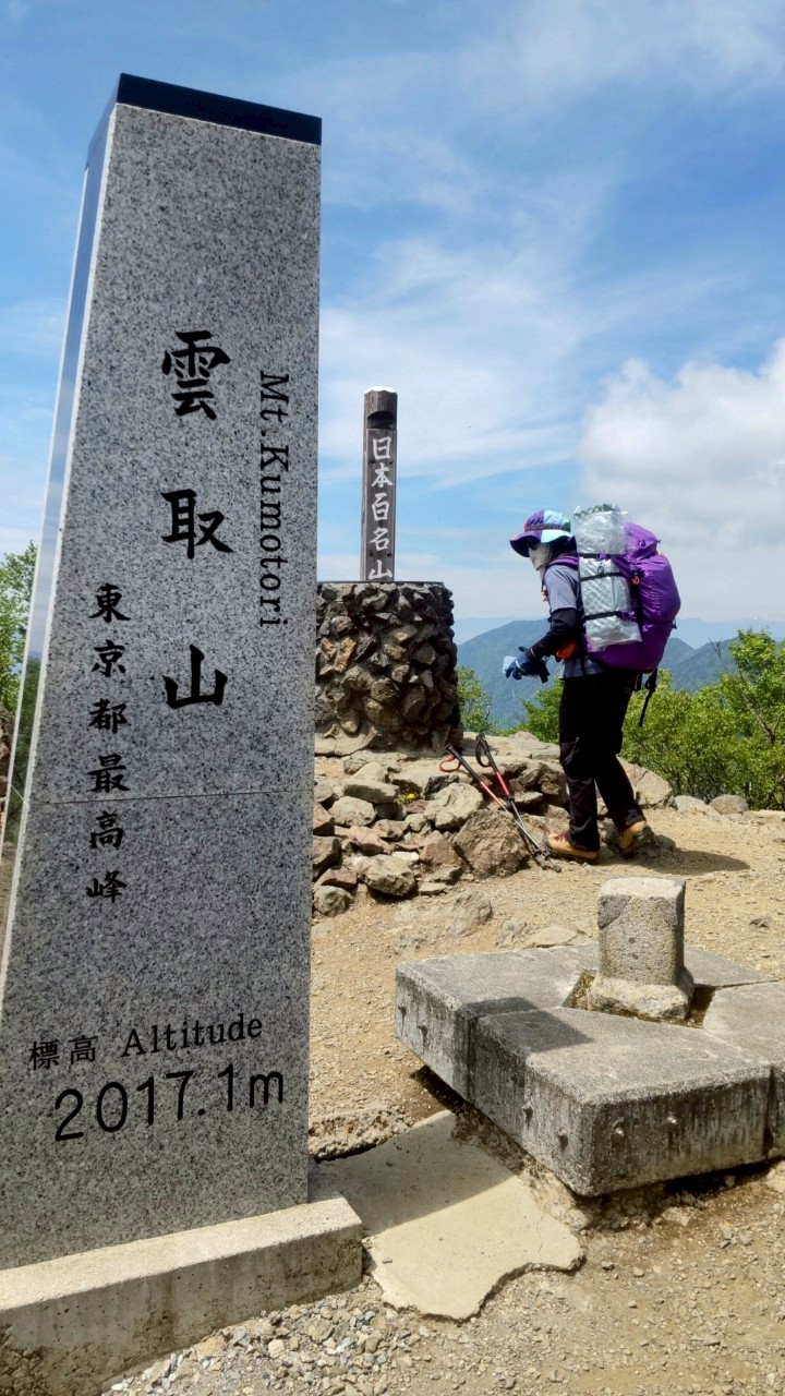
雲取山:埼玉百名山
MOUNT KUMOTORI
2026年6月18日(木)
¥22,000円(税込)(8:00集合)
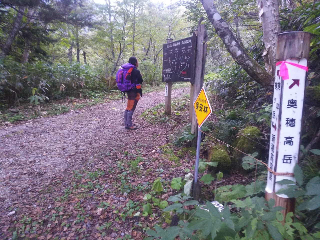
雲取山(くもとりやま)は、埼玉県秩父市・東京都奥多摩町・山梨県丹波山村にまたがる山で、標高2,017mは東京都の最高峰となっている。通年登れるが、5月中旬~6月上旬の新緑と、10月下旬~11月上旬の紅葉のころがベスト。奥多摩の山々や富士山を望む山頂へのコースは複数あるが、JR奥多摩駅からのバス便がある鴨沢バス停から石尾根経由のコースが一般的。危険箇所こそ少ないコースだが、体力が求められる。テント泊は、都心からのアクセスが良く、初心者にも人気の高い2,000m級テント泊デビューに最適な山です。テント泊可。埼玉百名山。
☆登山後の近くのお楽しみ☆彡
1年を通して涼しい日原鍾乳洞があります。
English
Mount Kumotori, spanning Chichibu City in Saitama Prefecture, Okutama Town in Tokyo, and Tabayama Village in Yamanashi Prefecture, is the highest peak in Tokyo at 2,017m. While climbable year-round, the best times are during the fresh greenery of mid-May to early June and the autumn foliage season from late October to early November. Several routes lead to the summit, offering views of the Okutama Mountains and Mount Fuji, but the most common is the route via Ishio Ridge from the Kamosawa bus stop, accessible by bus from JR Okutama Station. Although the route has few dangerous sections, it requires physical fitness. For camping, its easy access from central Tokyo makes it a popular choice for beginners, and it’s an ideal mountain for a first-time tent camping experience at a 2,000m-class mountain. Tent camping is permitted. It is one of the 100 Famous Mountains of Saitama Prefecture.
☆A nearby treat after climbing. ☆彡
There is the cool Niphara Limestone Cave, which is pleasant throughout the year.
| 行程 | 行動時間 | |
| 1,2日目 | 奥多摩駅(339m)奥多摩駅バス停<西東京バス/各自払い>=鴨沢バス停 下車(35分程)(540m)(平日8:00集合)…雲取山(2,017m)…雲取山泊(1,839m)(宿泊費各自払い)…2日目・鴨沢バス停 下車(35分程)(540m)16:00解散予定) ※歩行距離:28.3km×2日 ※食事:××× | 7~8時間 ×2日 |
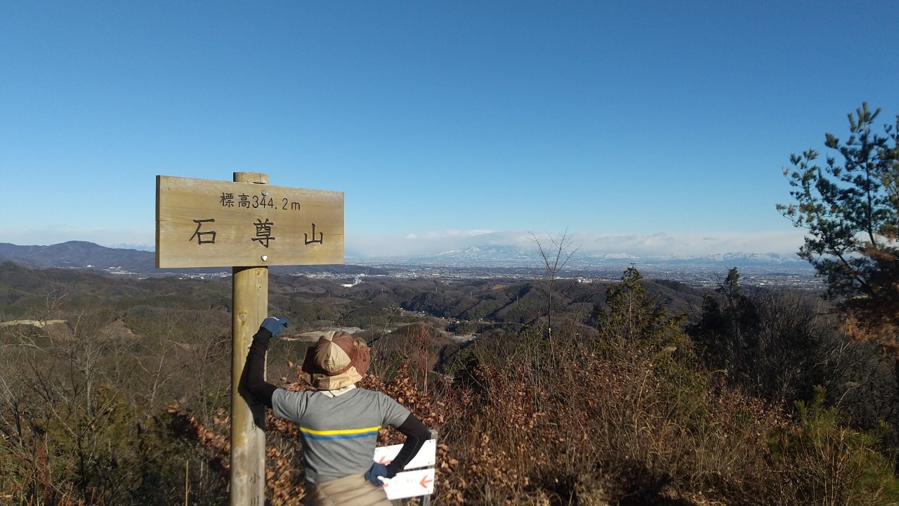
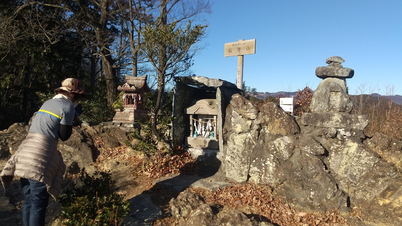
石尊山:埼玉百名山
MOUNT SEKISON
2026年6月25日(木)
¥3,300円(税込)(東武東上線東武竹沢駅8:00集合)
石尊山(せきそんやま)は、埼玉県比企郡小川町に位置する山である。隣接する官ノ倉山(かんのくらやま)(標高344m)も含む。秩父の山並みや小川町の田園風景を見渡せる絶景スポットで、特に山頂付近の岩場からの眺望が素晴らしいです。
☆登山後の近くのお楽しみ☆彡
手漉き和紙が有名で、埼玉県における初のユネスコ登録です。
小川町和紙体験学習センターで手漉き和紙体験ができます。
English
Sekison-yama is a mountain located in Ogawa-machi, Hiki-gun, Saitama Prefecture. It also includes the adjacent Kannokura-yama (elevation 344m). It is a scenic spot offering panoramic views of the Chichibu mountain range and the rural landscape of Ogawa-machi, with the view from the rocky area near the summit being particularly spectacular.
☆A nearby pleasure after mountain climbing.☆彡
Handmade Japanese paper is famous, and it is the first UNESCO registration in Saitama Prefecture. You can experience making handmade Japanese paper at the Ogawa Town Washi Experience Learning Center.
| 行程 | 行動時間 | |
| 1日目 | 東武東上線東武竹沢駅(平日8:00集合)(114m)…登山口(130m)…石尊山(344m)…東武竹沢駅(114m/16:00解散予定) ※歩行距離:11.0km ※食事:××× | 2~3時間 |
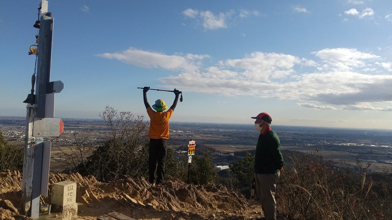
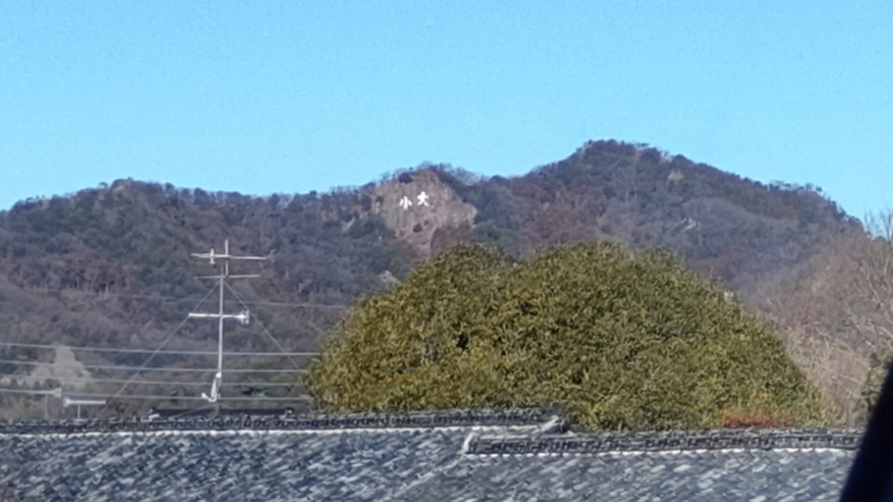
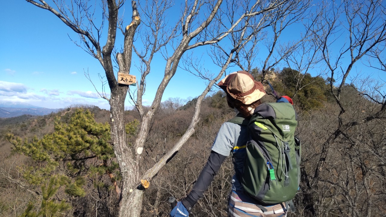
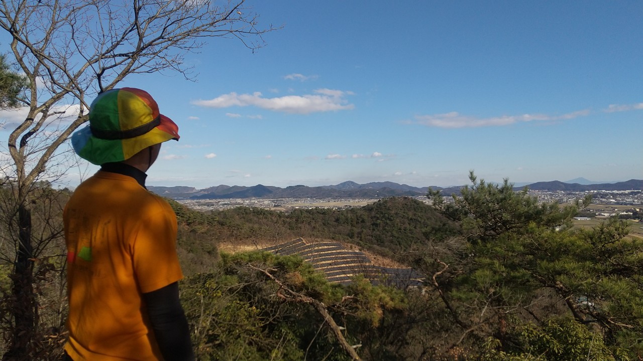
大小山:栃木百名山
MOUNT DAISYOU
2026年7月2日(木)
¥3,300円(税込)(×××集合)
大小山(だいしょうやま)は、栃木県足利市に位置する標高282mの山である。隣接する妙義山(313m)も含む。低山ながら岩場が多く、山頂の巨大な「大・小」文字板や、関東平野と渡良瀬川と一望できる360度のパノラマ絶景が人気のスポットです。急な岩稜歩きでスリルがあり、初心者から健脚者まで楽しめるハイキングコースです。栃木百名山。
登山後の近くのお楽しみ。
あしかがフラワーパークで四季折々の花を愛でることができます。
出流原弁天池があり、名水百選で栃木のモネの池と呼ばれる通り透明度が抜群です。
English
Daishoyama is a mountain located in Ashikaga City, Tochigi Prefecture, with an elevation of 282m. It also includes the neighboring Myogiyama (313m). Although it is a low mountain, it has many rocky areas, and is a popular spot for its giant “Dai-Sho” sign at the summit and the 360-degree panoramic view of the Kanto Plain and the Watarase River. The steep, rocky ridge walk is thrilling, and it is a hiking course that can be enjoyed by everyone from beginners to experienced hikers. It is one of the 100 Famous Mountains of Tochigi.
A nearby pleasure after mountain climbing.
You can enjoy seasonal flowers at Ashikaga Flower Park.
There is the Izuruhara Benten Pond, selected as one of the 100 famous waters, and as the name goes, it is called the Monet Pond of Tochigi, with outstanding transparency.
| 行程 | 行動時間 | |
| 1日目 | JR上毛線富田駅(平日8:00集合)(496m)…阿夫利神社登山口(74m)…大小山(282m)妙義山(313m)…富田駅(496m/12:00解散予定) ※歩行距離:8km ※食事:××× | 3.5~4時間 |
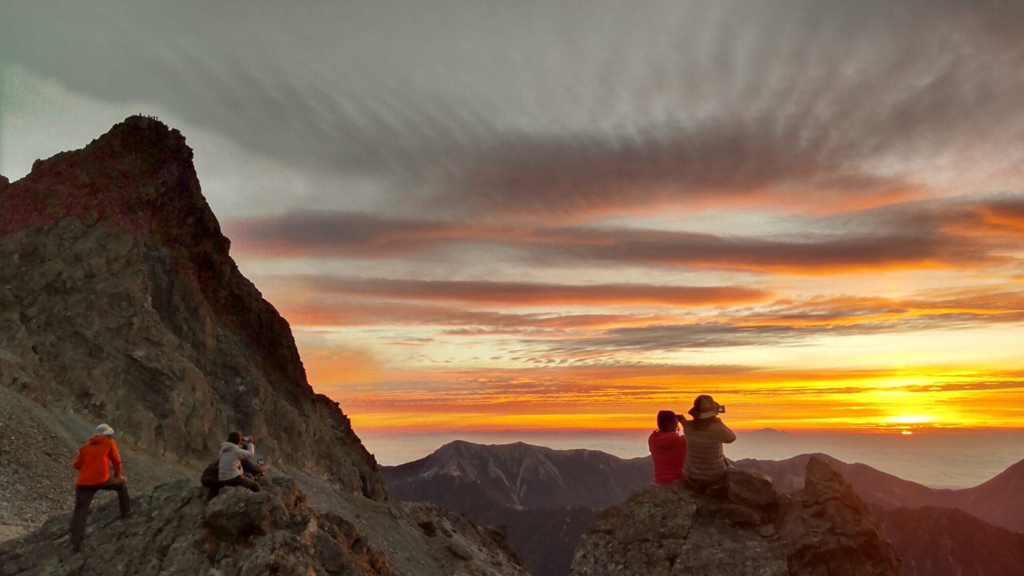
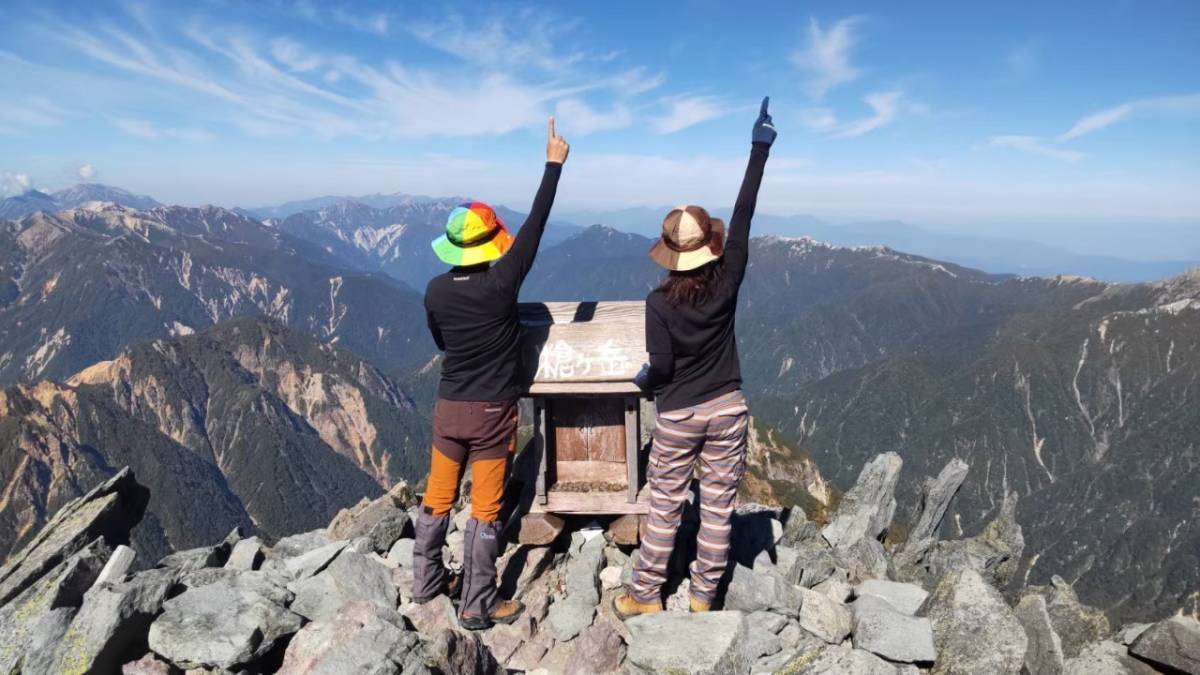
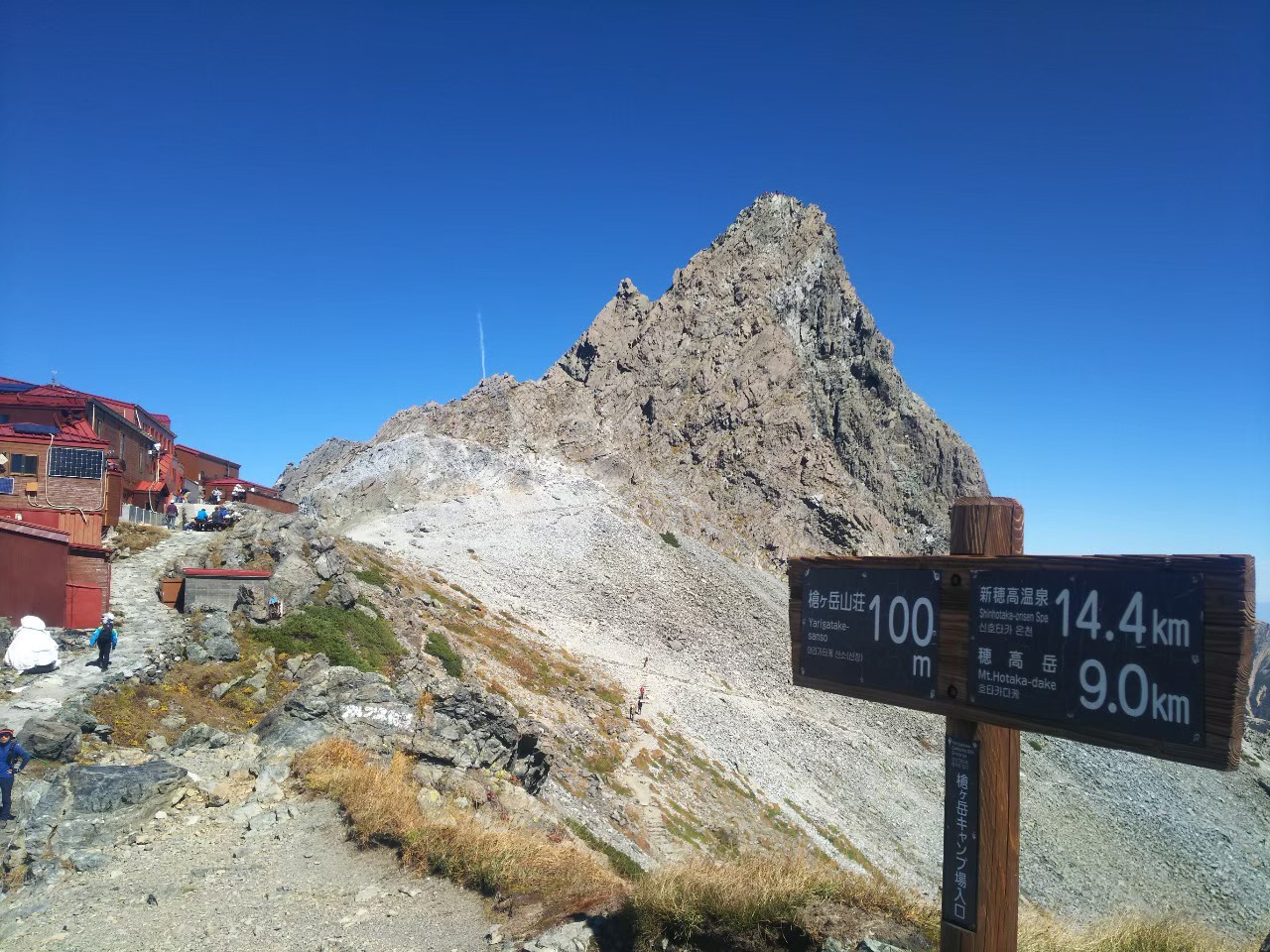
槍ヶ岳:日本百名山
MOUNT YARIGATAKE
2026年9月17日(木)
¥33,000円(税込)(5:00集合)
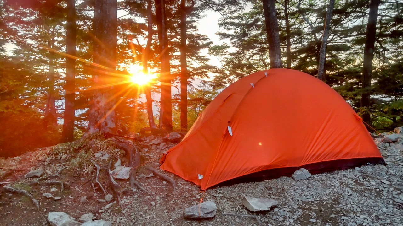
槍ヶ岳(やりがたけ)は、長野県と岐阜県の境界に位置し、飛騨山脈(北アルプス)の南部にある標高3,180mの山である。「日本のマッターホルン」とも呼ばれる美しい山です。穂先が真っ赤に染まる「モルゲンロート(朝焼け)」は息をのむ美しさです。山頂からは、雲の上に突き出た穂高連峰や富士山まで見渡すことができる。テント泊は、頂上直下の槍ヶ岳山荘テント場(約3,000m)が人気で、絶景と360度のパノラマを楽しめます。日本百名山。
登山後の近くのお楽しみ。
新穂高温泉神宝乃湯は、新穂高センターに併設されており、絶景の露天風呂があり、景色を眺めてゆったり入浴できます。
English
Mount Yarigatake is a 3,180m-high mountain located on the border of Nagano and Gifu prefectures, in the southern part of the Hida Mountains (Northern Alps). It is a beautiful mountain often called “Japan’s Matterhorn.” The “Morgenrot” (morning glow), when the peak is dyed bright red, is breathtakingly beautiful. From the summit, you can see the Hotaka mountain range and even Mount Fuji jutting out above the clouds. For camping, the Yarigatake Mountain Hut campsite (approximately 3,000m), just below the summit, is popular, offering spectacular views and a 360-degree panorama. It is one of Japan’s 100 Famous Mountains.
A nearby treat after mountain climbing.
Shinhotaka Onsen Kamitakara-no-Yu is attached to the Shinhotaka Center, and it has an open-air bath with a spectacular view, allowing you to relax while enjoying the scenery.
| 行程 | 行動時間 | |
| 1,2日目 | <マイカー限定>新穂高センター近くの無料駐車場…新穂高センター(2,000m)(平日5:00集合)…穂高平小屋…滝谷避難小屋…槍平小屋…槍ヶ岳(3,180m)…槍平小屋…滝谷避難小屋…穂高平小屋…新穂高センター(2,000m/16:00解散予定) ※歩行距離:30km ※食事:××× | 12時間 ×2日 |